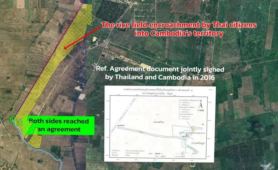
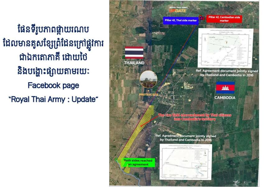
Cambodia’s Ministry of National Defence said maps unilaterally used by Thailand and satellite imagery showed Thai residents occupying Cambodian land in ព្រៃចាន់ village, អូរបីជាន់ commune, អូរជ្រៅ district, Banteay Meanchey province.
The ministry said the land was outside the disputed areas and that Cambodia would continue seeking a peaceful solution through the Joint Boundary Commission (JBC).
It condemned what it described as Thai troops and Sa Kaeo authorities installing fences, barbed wire and tyres and expelling Cambodian residents of ព្រៃចាន់ and ជោគជ័យ villages, calling the actions a violation of Cambodian sovereignty.
Major General ឆេង ឃុន, a deputy director of the geographic department, said investigations around Thailand’s unofficial boundary markers 42–43 confirmed Thai residents’ occupation of Cambodian land. This was the finding reported by the Cambodian authorities.
He accused Thailand of double standards, showing material alleging Cambodian encroachment on Thai land while not showing Thai residents occupying Cambodian land.
Reported by Preah Sihanouk Provincial Television